
A Winter Expedition Off Roading in West Virginia’s Allegheny Mountains
Kicking off 2024 with a winter off-roading adventure in West Virginia’s Allegheny Mountains presented an unparalleled experience.
Editor Note: This post is associated with “Chasing Snow-Capped Views: Two of West Virginia’s Fire Towers in Winter,” featured on our partner site, Abandoned.
The weekend’s weather forecast predicted a severe winter storm, expecting up to 12 inches of snow and temperatures fluctuating from mid-teens at night to mid-30s during the day. These conditions were perfect for camping enthusiasts who prefer the absence of mosquitoes, ticks, and extreme heat.
I arrived at Backbone Mountain in Tucker County late at night, seeking a remote camping spot to photograph the sunrise from the Backbone/Olson Tower site. The Backbone Tower, erected in 1922 on Backbone Mountain, holds the distinction of being the first fire tower in the state. It was eventually handed over to the U.S. Forest Service and remained in use until 1963 when it was replaced by Olson Tower, named in honor of Ernst B. Olson for his 28 years of service in fire control and conservation with the Monongahela National Forest.
The journey to the site was manageable despite the snow-covered gravel road. Nestled among pine trees, I prepared my car for a night of camping, setting up insulating window shades, a Hest memory foam mattress, a 20-degree sleeping bag, and a blanket, ensuring a comfortable slumber.
Waking up hours later, I was greeted by one of the most stunning sunrises I’ve ever captured. I quickly launched my drone into the chilly morning air, capturing the sky’s purple and pink hues during the civil twilight.


As the sun rose at 6:59 AM, I maneuvered the camera to catch the sun’s rays filtering through the fire tower’s windows.


I devoted some time to photographing various snowy scenes around the fire tower site, including images of the Allegheny Trail and my Subaru Outback Wilderness in its natural habitat. After this, I headed into town to join a group of off-roading enthusiasts from the MtnRoo brotherhood.


In Davis, our group convened before setting off to our initial destination, the Backbone/Olson Tower, for a group photo prior to tackling our first trail. Accompanying me on this journey were Michael and Richard from Virginia in their Ford Bronco Sport Badlands (positioned on the left in the photo), Aaron with his Subaru Outback Wilderness (left-center), and Ryan, also in a Subaru Outback Wilderness (on the right).
My vehicle was a stock Subaru Outback Wilderness, equipped with 9.5 inches of ground clearance, Yokohama Geolandar all-terrain tires, and front skid plates. Compared to the rest of the group, my vehicle seemed modest; others had more robust all-terrain tires, rock sliders, stronger skid plates, and winches. Despite this, I was confident in my Subaru’s ability to navigate the trails, fully aware of its limitations and strengths. It may not be a Jeep or a rock crawler, but it was well-suited for our adventure.

I’ve ventured off the typical paths in my travels, but never have I faced a challenge like we did that day. My vehicle is also my daily driver, and I had previously avoided “extreme” routes due to concerns about not being able to rescue my vehicle or causing severe damage.
After leaving Olson Tower, we retraced our steps to Canyon Rim Trail, a seven-mile route connecting Backbone Mountain to Thomas. This path, once a logging railroad turned forest road leading to Big Run Falls, has deteriorated significantly due to neglect by the United States Forest Service. Two major washouts have made the road impassable for most, leaving it open only to those seeking a true adventure. It’s important to emphasize that Canyon Rim Trail is not for the unprepared. Vehicles with less than eight inches of ground clearance will likely scrape against rocks, and those without all-terrain tires will struggle to navigate the deep ruts and mud pits.


The most formidable obstacle we encountered was a washout that had become increasingly treacherous over the years. Initially, it appeared intimidating, but descending the slope was surprisingly manageable. However, ascending from the washout was a different story. My apprehension grew due to my tires not being at full tread depth, combined with the slippery, muddy conditions. When I accelerated, my Subaru began to slide towards a small ravine on the left. Fortunately, the Deep Snow/Mud X-Mode in the Subaru was effective, maximizing traction even as the wheels spun.
Another member of our group, driving the Bronco Sport, wasn’t as fortunate and slid into the ravine on the right. What followed, however, was an impressive display of teamwork and recovery. With the group shouting instructions, the Bronco driver managed to straighten the wheels and reverse out, catching some air in the process!


The rest of our drive on the Canyon Rim Trail was smooth. Hunger set in after a few hours, leading us to Hellbenders, a well-liked burrito joint in the area. This place had closed temporarily during the COVID-19 pandemic and initially reopened with limited hours. Fortunately, it’s now fully back in business.
After our meal, Ryan, Aaron, and I headed to our campsite for the night, located along Canaan Loop. This trail, formerly a logging railroad and now a forest road, is maintained for about 9 miles up to Table Rock Trail, with several dispersed campsites along the way. The road itself, a simple gravel two-track, wasn’t too difficult. However, a foreboding sign indicating that passenger cars were not advised beyond Table Rock intrigued me, hinting at more challenging terrain ahead.

For anyone considering driving the remaining 4.7 miles of Canaan Loop towards Lindy Point at Blackwater Falls, I strongly recommend using a vehicle with high clearance, equipped with skid plates, and some form of recovery gear in case of getting stuck. Beyond this point, the road deteriorates significantly into what’s known as a “pinstripe path.” If you’re particularly cautious about maintaining your vehicle’s ceramic coating and washing it frequently, this trail might not be suitable for you.

As we navigated through the mud that had turned to ice, Ryan’s vehicle lost a fender well, and soon after, I also ripped off my driver’s front fender well. Fortunately, it came off cleanly, so I placed it on top of my car, hoping to possibly repair it once I returned home.

Ryan carrying back his fender well.
The journey became increasingly challenging with stream crossings at Laurel Run and several other unnamed tributaries. Navigating the descents demanded careful coordination and skill. During this time, the limitations of my less-than-ideal tires became evident, especially when trying to ascend a steep ravine. My tires struggled on the wet and slippery, balding rocks, failing to gain traction regardless of the speed or torque applied. Eventually, Ryan had to assist in pulling me up the hill while I accelerated. This experience was a valuable lesson.

As daylight faded, we reached our campsite nestled under pine trees. Ryan quickly started a fire, and we gathered around it, enjoying a few drinks and engaging in conversations about our past, present, and future travels. The weather, however, was less than perfect, with the snow turning into a light rain. We prepared our Subarus for an overnight stay and decided to retire early.
The following morning, we woke up to find a fresh layer of snow adorning the surrounding pines. The rain had ceased, giving way to a robust snowstorm. Our journey was nearing its end, with just a few miles left to reach our destination at Lindy Point.


Our progress was smooth until we encountered a deep ford. Under normal conditions, this wouldn’t have been a problem, but the combination of heavy snowfall, melting snow, and rainfall had significantly increased the stream’s volume. Additionally, we had to maneuver around several boulders. To assess the depth, Aaron threw a rock into the water, which made a solid thunking sound, indicating deep water. Despite this, turning back wasn’t an option as we were too far along the trail.
Ryan took the lead, cautiously navigating through the water that rose to the height of his rear bumper. Fortunately, he crossed successfully. Then it was my turn. I was at a slight disadvantage with my Subaru’s standard height of 9.5 inches and no rear differential breather. However, having already crossed streams earlier in the trip and with previous experience, I felt confident. My crossing was smooth and unproblematic.
Next, we faced a steep incline littered with boulders. Ryan carefully navigated a path and ascended effortlessly. I followed, albeit with less confidence, but I pressed on, relying on the Subaru’s X-Mode. To my relief, I managed to scale the rocky terrain without any problems. We soon reached Lindy Point, just in time. Eagerly, we hiked to the overlook, but unfortunately, the heavy snowfall obscured our view. The combination of snow and ice, along with winds exceeding 30 miles per hour, was overwhelming. Deciding to seek shelter, we headed to Blackwater Falls lodge for breakfast.

After breakfast, we each went our separate ways. I remained in the area for a few more hours to photograph the ongoing construction of Corridor H, intending to feature these images in a post for my associated website, Bridges & Tunnels.
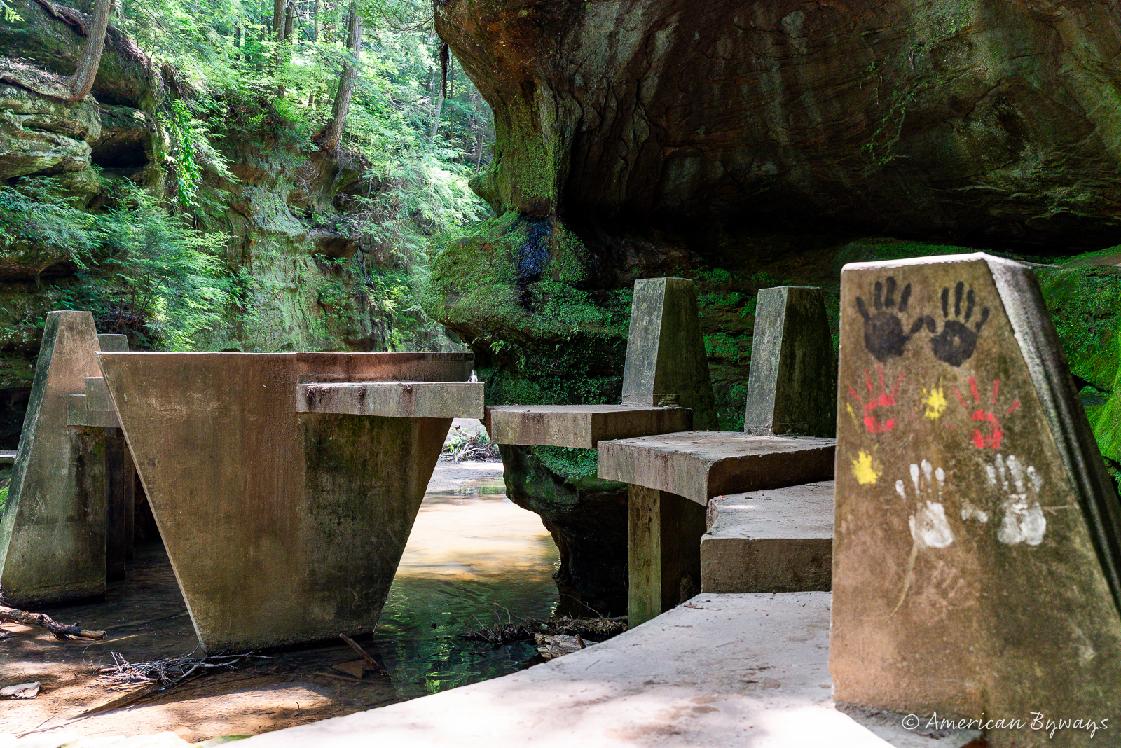
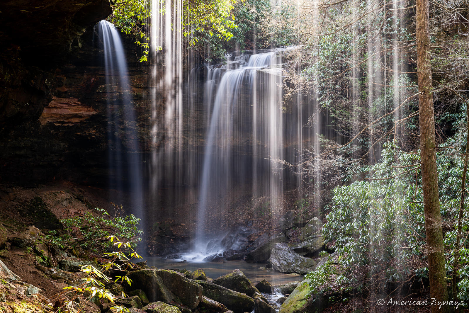
I also revisited Greenland Gap, a strikingly beautiful water gap carved by the North Fork of Patterson Creek through New Creek Mountain. Named after the lush surroundings of the nearby Greenland community, this serene location is encircled by majestic Oriskany Sandstone cliffs, rising over 800 feet. While the snowstorm had been intense in the Davis and Thomas regions, at Greenland Gap, it was merely a light drizzle. Thankfully, the hike to Patterson Creek Falls was straightforward. This waterfall, a 15-foot cascade, plunges into a 10-foot deep pool, offering a picturesque, quiet scene.


As I reflect on this remarkable off-roading adventure in West Virginia with my friends from the MtnRoo community, I am filled with a sense of pride and gratitude. From the challenging climbs and descents along the Canyon Rim and Canaan Loop trails, each moment was a testament to the resilience and camaraderie we shared. The journey wasn’t just about testing the limits of our vehicles; it was a celebration of the bond that unites all who cherish the thrill of exploration and the beauty of nature.
As I drove back home to Kentucky, the snow-covered roads of Corridor H and US Routes 48 and 219 seemed to echo the quiet contentment of a journey well-traveled.
Discover more from American Byways
Subscribe to get the latest posts sent to your email.
Mark M
These are some great photos. I pass right by the tower on my way from Manassas, VA to Philippi, WV all the time….
Sandy
Thanks for sharing. I’ve often wondered about the Canaan Loop Rd if it was passable. Looked like a nice adventure.
Kim L Beckett
Great photos! We love to 4 wheel and have a 1970 Bronco. We live in CO, but are considering moving to the Roanoke area to retire in a couple years. Keep the stories coming!
Chuckster
Once described, I was hoping to see some of the sunrise photos taken via the drone. Is there a link to those? But what I saw was cool, thanks for sharing.
American Byways
Top three galleries in this post are drone shots.
Chuckster
Ahh, I see them now. Terrific. They did not show on my thumb browser. Thanks mate!